AI Stock Aerial Images Generator
Top-down or oblique, blue hour or storm light, urban grid or desert dune: one prompt covers the altitude, the subject, and the time of day. Commercial rights on every paid plan.
Auto mode picks the model; you direct the shot.
Every top image model sits behind one subscription. The auto routes by what you describe.
How to generate custom aerial images with getimg.ai
Most aerial briefs hinge on three cues: the subject, the altitude, and the light. Name them in the prompt.
1. Type the flight
Open the Content Generator and describe the aerial scene: the subject, the altitude, the light. A simple prompt produces a usable baseline; name the city, the coastline, or the time of day when you want exact control over those details.
2. Run a count
Generate anywhere from one to sixteen variations at a time, then read the results for altitude, camera angle, light direction, and the way shadows fall across the subject. Pick the version that lands.
3. Change a detail
A first run picks one of many valid aerial interpretations from your prompt. If you'd rather end up at Big Sur fog at dawn instead of the Tahoe glacier at midday, or a top-down grid instead of a 45-degree oblique, name the swap and run again. Several changes fit one prompt; download when it lands.
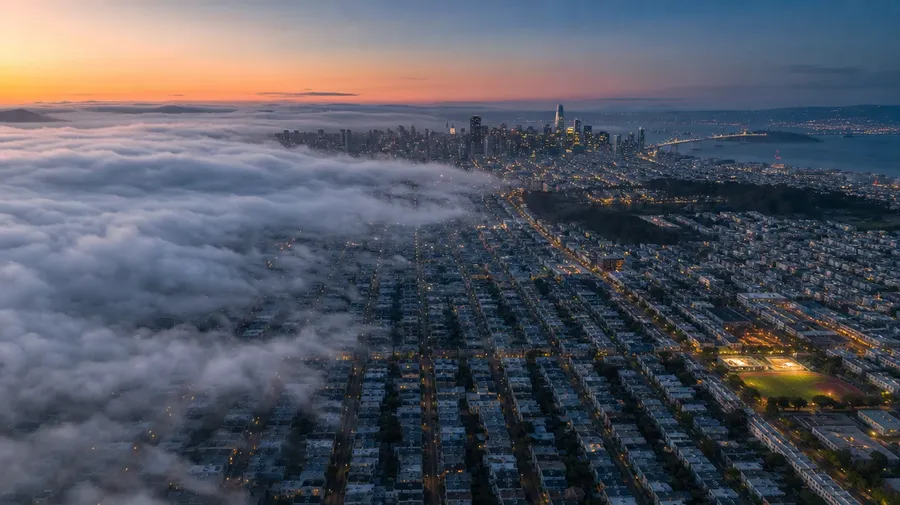
top-down san francisco grid at blue hour, fog rolling in from the pacific, drone aerial, soft shadow falloff
Beyond the postcard aerial
Real aerial briefs cover the locations and times the stock libraries skip.
Every subject the camera reaches
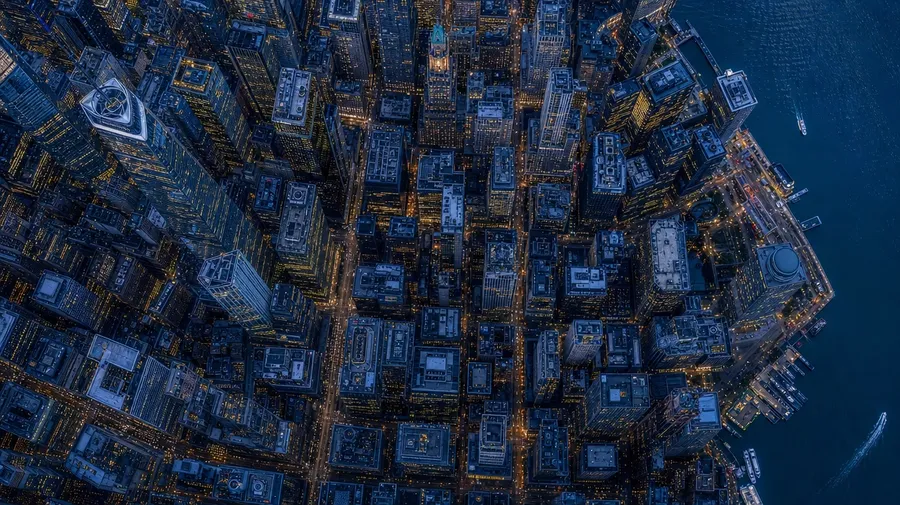
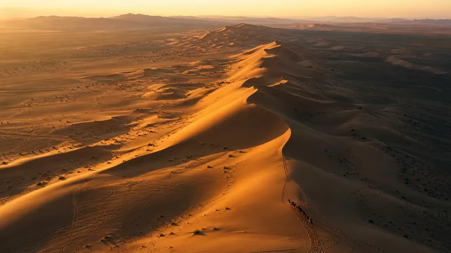
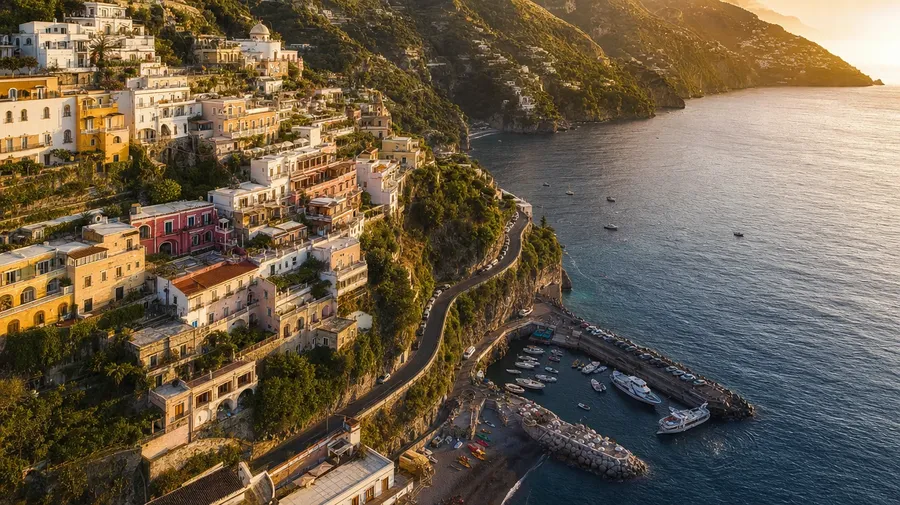
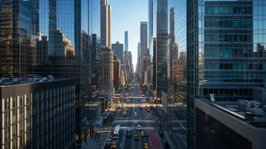
Cover every subject the camera reaches: a Manhattan financial district at blue hour, a Big Sur coastal cliff in fog, a Sahara dune ridge at dawn, an Icelandic glacier with melt rivers, a Bangkok highway interchange at rush hour. Each subject brings its own scale, shadow length, and palette.
Top-down to oblique, every altitude
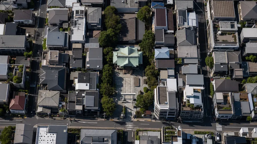
Cover every angle of the flight: a top-down geometric crop of a Tokyo neighborhood, a 45-degree oblique over an Amalfi coastline, a low-altitude pull through a Manhattan canyon, a god's-eye on an Icelandic crater, a horizon-line approach over a Patagonian fjord. Different altitudes, same prompt box, the model handles the parallax.
Industrial, agricultural, ceremonial scenes
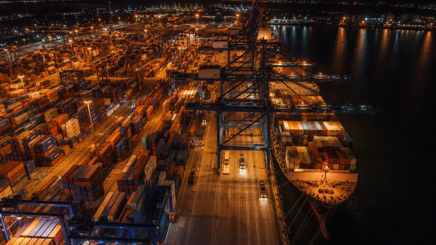
Catalog aerials stop at the postcard shot. Real briefs span the work aerial photographers actually shoot: a mining pit at first light, a wheat-field combine sweep at harvest, a hajj crowd at the Kaaba, a Day-of-the-Dead procession in Oaxaca, a container port at midnight. Subjects the stock libraries never book.
Frequently Asked Questions
Generate unique aerial images in seconds.
Type the subject, the altitude, and the light. The model handles the parallax, the shadow falloff, and the way the city catches the blue hour.